We are doing maps for specific routes, with the idea that a single silk map would include a day's or weeked's activities.
In the Adirondacks, for example, there are the various challenges and the regional sets of trails.
These maps will be based on the USGS or other topo maps, but can have variable additional information including trail profiles, cell phone coverage, and other items of interest to the hiker.
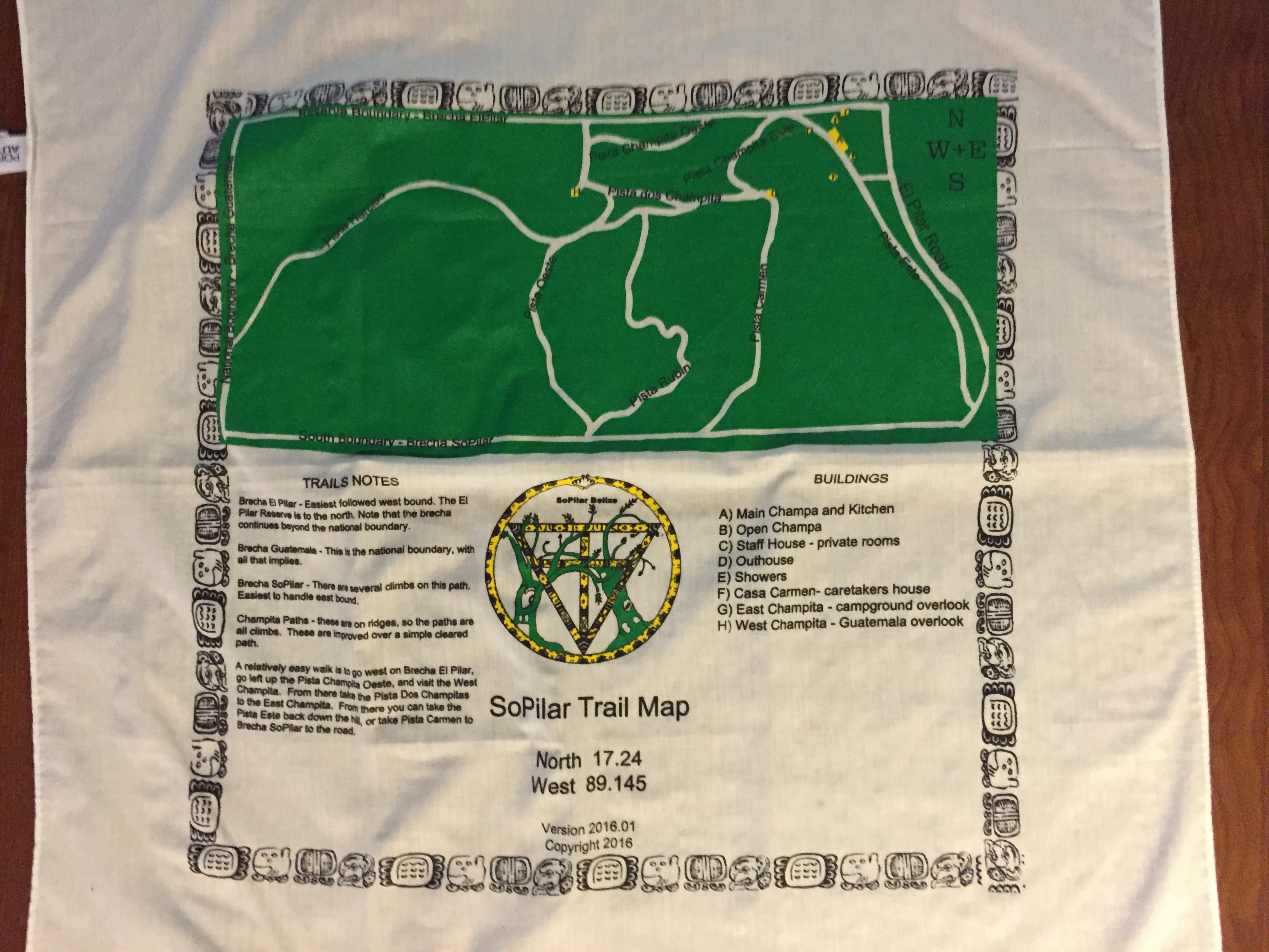
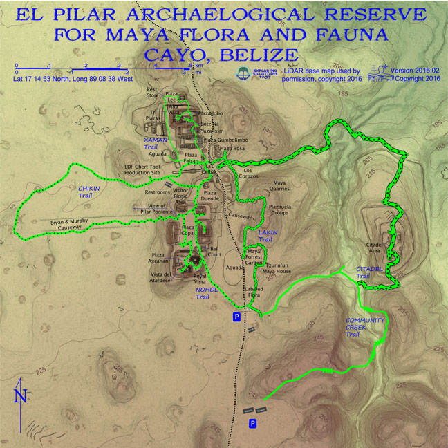
The So Pilar map is an example of a simple trail map, with outlooks and buildings noted. The El Pilar map is the final design for a new product, now being printed.
Vision
Outlet
Special Features
Expected Use
Our Process
Powered by Notepad
Yes, this is just handwritten HTML.
Please report page problems by clicking here.